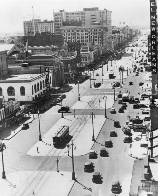
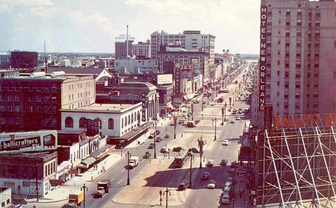
Two views in toward the river from Liberty Street. The upper picture is a 1930s view. We see several streetcars on the inner tracks; these would be Canal-Cemeteries and West End cars. In the middle of the picture, we see two of the left-turn tracks on Canal Street, both at the Crozat/Loyola (formerly Franklin, later Saratoga) intersection. The track to our right leads Tulane Belt cars to Tulane Avenue, and the track to our left leads around the block to come out at the left foreground on Liberty Street. This was the terminus of the Spanish Fort line trains until that line was abandoned in 1932. The lower picture shows the riverbound outer track after it was extended in 1947 from Liberty to Rampart. This was used by the St. Charles Belt cars after their approach to Canal Street was moved from Rampart to Liberty. A bus can be seen crossing Canal at Burgundy. Louisiana News Co. (lower)