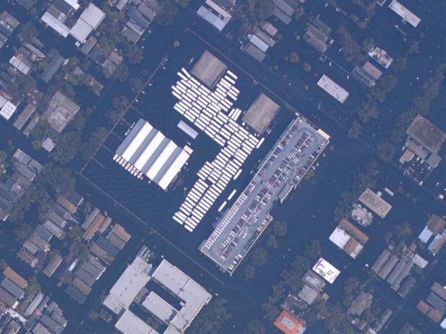
The central square of this satellite picture, shown tilted, is flooded Canal Station, the A. Phillip Randolph Transportation Center. The main building is the large block to the lower right of center. The streetcar Service, Inspection, and Storage facility (SIS) is at center left. A row of streetcars can be seen peeking out of the front doors. The white rectangles filling the yard are diesel buses. Canal Street runs from the upper right to the lower center of the picture. The floodwaters show up almost black, surrounding everything. National Oceanic & Atmospheric Administration (NOAA) photo