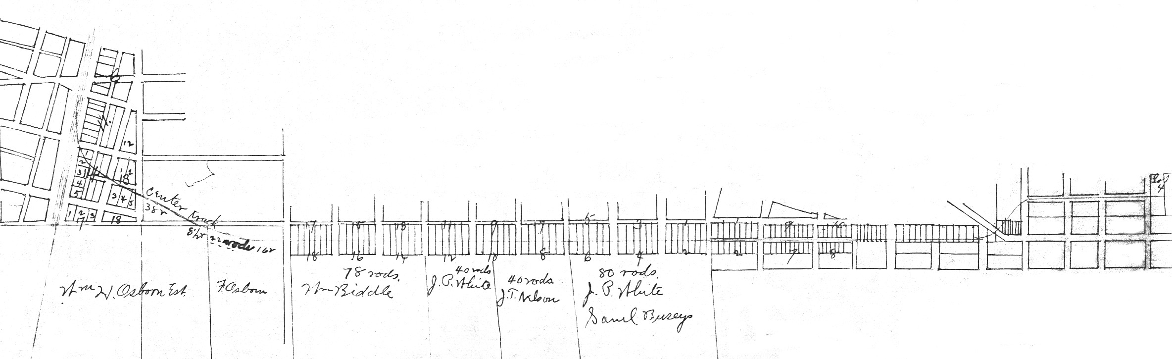
Map 2-1.
The plat for the route between downtown Urbana and the Illinois Central
depot (the Doane House). This is copied from Champaign County records.
Unfortunately, it is not as clear as might be wished, but the route is
there! Most of it is a straight east-west line parallel to, and about
200 feet south of, the Springfield Road (later called Springfield Avenue),
which is the main east-west street on the map. This became the private
right-of-way for horse and later electric streetcars. It was known
informally as Railroad Street, but it was not a publicly-owned street until
after the tracks had been removed. The next two maps show the west
(Champaign) and east (Urbana) ends of the map.
 Below is an enlargement of the map.